In 1998 Kenya, Somalia, and California had record rainfall resulting in all kinds of problems like flooding.
At the same time, Indonesia had the worst drought on record. In the south pacific 16 cyclones occurred compared to the average of 8.
Why all this extreme weather? El Niño.
El Niño is a climate pattern that takes place in the South Pacific. It takes place roughly every 2 to 7 years. If the average sea surface temperature iss+0.5°C warmer for at least five consecutive 3-month periods, an El Niño is present.
Let’s try to understand what causes El Niño.
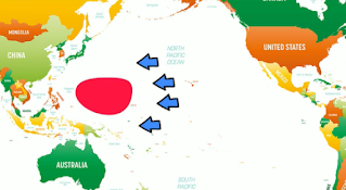
During normal conditions trade winds blow east to west and push warmer water on the surface west and this water piles up in the western pacific.
At the same time, on the eastern side around south and central America as the warm water is pushed west it is replaced with cold water in a process called upwelling.
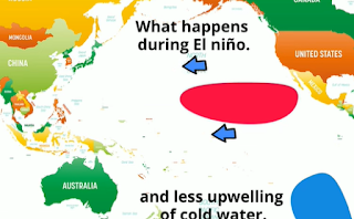
However, some years the trade winds are weaker. Like in 1998. This results in the warm surface water not being pushed as far westward and remains near the east coast.
One result is that the Jet Stream moves southward which can result in the Northern Us and Canada being warmer.and dryer and increased rainfall in the southern US along with drier areas in south Asia.
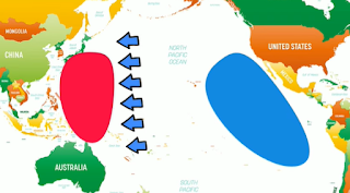
Eventually the trade winds regain their strength and some years ther will be stronger than normal and the opposite happens.The warm surface water is pushed further west and this allows more upwelling of cold water on the east.
If the sea surface temperature is 0.5 F degrees colder than normal, it's a La Niña.
This may sound odd since La Niña occurs in the pacific but La Niña increases the chances of hurricanes in the Atlantic ocean due to its impact on atmospheric pressure.


0 comments:
Post a Comment